

How Aerial Drone Photography Is Reshaping the Way Homes and Properties Get Marketed

The real estate industry has always been a visual business. Buyers decide within seconds whether a listing is worth a second look, and that decision is made almost entirely through images. For decades, those images came from a photographer standing on the ground with a wide-angle lens, doing the best they could with the vantage point available. That vantage point has now changed permanently, and the shift is redefining what "good marketing" means for agents, developers, and property managers alike.
Aerial photography, once reserved for luxury estates and commercial developments with big budgets, has become an accessible, everyday tool. Drones can now capture a property from angles that no ladder, drone-less camera crane, or handheld shot could ever replicate. The result is marketing material that does not just show a property; it sells the lifestyle and the surrounding context that buyers are actually paying for.
Why Perspective Changes Everything in Property Marketing
A buyer scrolling through listings online is not just evaluating square footage or the number of bedrooms. They are imagining a life: the morning commute, the walk to the nearest park, the view from the backyard at sunset. Ground-level photography can capture the interior beautifully, but it struggles to communicate the bigger picture, literally.
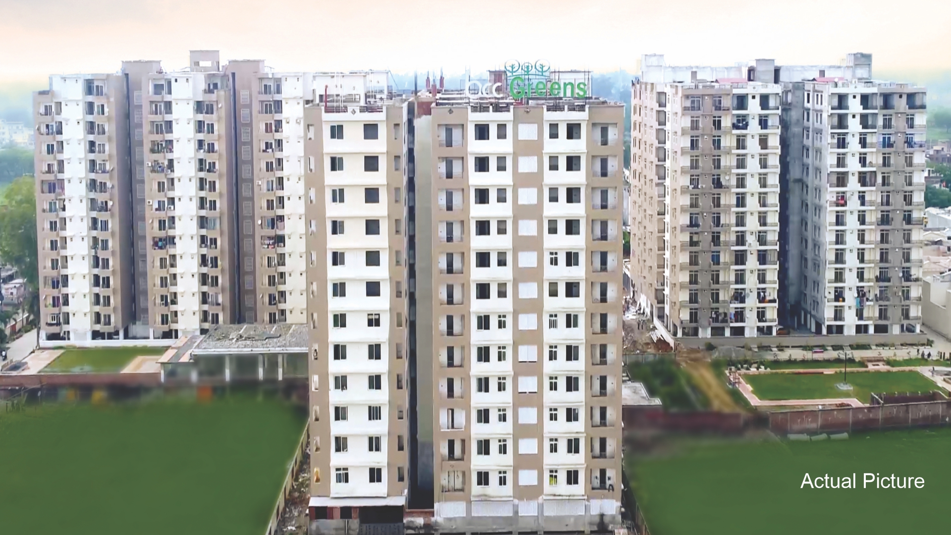
An aerial shot solves that problem instantly. It shows how a property sits on its lot, how close it is to a lake or greenbelt, how the roofline and landscaping come together, and how the neighborhood itself is laid out. For larger properties, ranches, and commercial parcels, this is not a nice-to-have, its essential information that a buyer needs before they will even schedule a showing.
Real estate professionals who have adopted drone aerial imaging services in real estate report that listings with aerial visuals tend to attract more interest and hold attention longer than those relying solely on ground-level photography. That is not surprising. Elevated perspective removes ambiguity. It answers the questions a buyer would otherwise have to ask an agent directly, which speeds up the decision-making process on both sides.
The Shift from "Nice Extra" to Marketing Standard
Five years ago, drone photography was something agents mentioned as a premium add-on for high-value listings. Today, it is approaching the status of a baseline expectation, particularly in markets where competition among listings is fierce. Buyers have grown accustomed to seeing aerial establishing shots, and a listing without one can feel incomplete by comparison.
This shift mirrors what happened with professional photography itself a decade ago. Once a handful of agents started using DSLR cameras and staged shots instead of dim, cluttered smartphone photos, the entire market had to catch up or risk looking outdated. Drone imagery is following the same trajectory, only faster, because the technology has become so much more affordable and the software that processes the footage has gotten dramatically easier to use.
Developers and property managers overseeing multi-unit or commercial assets have been especially quick to adopt this approach. A commercial parcel benefits enormously from aerial context: proximity to highways, visibility from major roads, parking layout, and surrounding infrastructure are all things a buyer or investor wants to evaluate before ever stepping foot on the property. Static ground photography simply cannot deliver that information in a single glance.
Beyond Photos: Video, Virtual Tours, and Twilight Shots
While still images remain the foundation of most listings, video content has become one of the fastest-growing formats in property marketing. A short aerial video that glides over the property descends toward the entrance and transitions into an interior walkthrough gives buyers a sense of flow and scale that photos alone cannot replicate. This kind of footage performs particularly well on social platforms, where movement captures attention in a crowded feed far more effectively than a static image.
Twilight photography, where a drone captures the property during the "golden hour" just after sunset, with interior lights glowing and the sky still holding color has become a favorite technique among top-performing listings. It is a small production detail, but it consistently outperforms daytime-only photo sets in engagement metrics, largely because it makes a property feel warm, lived-in, and aspirational rather than clinical.
Some agencies have gone a step further, combining aerial footage with 3D virtual tour technology so that prospective buyers can explore a property from their phone before ever scheduling an in-person visit. This has proven especially valuable for out-of-state buyers, relocation clients, and investors who need to narrow down a shortlist remotely before committing travel time to physical showings.
What Separates Effective Aerial Marketing from Generic Drone Footage
Not all drone content is created equal, and this is where a lot of agents and marketers get it wrong. Simply flying a drone over a house and snapping a few shots from directly above does not automatically produce marketing-grade material. Effective aerial marketing requires an understanding of composition, lighting, flight planning, and how the footage will ultimately be used across different platforms.
A well-planned aerial shoot considers the time of day, the angle of the sun relative to the property, the surrounding landscape features worth highlighting, and even local airspace regulations that might restrict flight paths near certain areas. Teams that specialize in this work also know how to edit and grade footage so that colors are consistent across the full set of images, rather than looking like they were shot on different days under different conditions.
This is why working with a team that treats aerial content as part of a broader marketing strategy, rather than a standalone gimmick, tends to produce noticeably better results. Firms offering structured real estate drone marketing programs typically build the aerial content directly into the listing's overall visual narrative, coordinating it with ground photography, floor plans, and video so that everything feels like one cohesive package rather than a mismatched collection of media.
The Data Side of Aerial Marketing
There is a practical dimension to this technology that goes beyond pretty pictures. Drones equipped with mapping software can generate accurate lot boundary overlays, elevation data, and even rough acreage calculations for larger parcels. For land sales, agricultural properties, and undeveloped lots, this data can be layered directly onto the marketing material, giving buyers a much clearer sense of what they are actually purchasing.
This is particularly useful for properties where boundaries are not obvious from the ground, such as wooded lots, rural acreage, or parcels with irregular shapes. Instead of relying on a buyer's imagination or a flat, hard-to-interpret survey document, an aerial overlay communicates the same information visually and immediately.
For commercial real estate, this same data can support site-planning conversations. Investors evaluating a property for redevelopment or expansion often want to understand setbacks, existing structures, and available space before they will commit to a deeper conversation. Aerial mapping data shortens that evaluation process considerably.
How This Affects Search Visibility for Listings and Agent Websites
There is also a search and discoverability angle worth understanding. Listings and property pages that include rich, well-optimized visual content, including properly tagged aerial images and video, tend to perform better in both search engines and on-platform algorithms that reward engagement. Time-on-page, video completion rate, and image interaction all factor into how prominently a listing gets surfaced, whether that's on a real estate portal, a brokerage website, or social media.
Agents and agencies that treat their listing pages as content assets, rather than static forms, are seeing the benefit of this. A property page built around strong aerial visuals, clear descriptions, and properly structured metadata gives search engines more signals to understand what the page is about and whom it is relevant for. This matters just as much for local search visibility as it does for individual listing performance, since buyers frequently search by neighborhood, school district, or nearby landmarks before they ever search by address.
Practical Considerations Before Hiring a Drone Marketing Service
Agents and property owners considering aerial marketing for the first time should keep a few practical points in mind. First, licensing matters. Commercial drone operation requires certification, and working with an unlicensed operator can create liability issues down the line. Second, insurance coverage should be confirmed before any flight takes place, particularly for properties near airports, power lines, or other restricted airspace.
Third, it is worth asking how the footage will be delivered and in what formats. A listing needs still images sized appropriately for MLS uploads, video formatted for social media, and often a longer-form version for a dedicated property website or YouTube. A provider who understands these different endpoints will save significant time in post-production.
Finally, timing matters more than most people expect. Weather, foliage, and even the position of the sun relative to a property's best angles can all affect the final quality of the shoot. A rushed, same-day booking rarely produces the same results as a shoot planned a few days in advance with attention to these variables.
Where This Is Heading
The next phase of aerial real estate marketing is already taking shape. Automated flight paths that capture consistent, repeatable shots across an entire portfolio of listings are becoming more common, which helps larger brokerages, maintain a consistent visual brand across hundreds of properties. Integration with AI-assisted editing tools is also speeding up turnaround times, meaning agents can go from shoot to published listing in a fraction of the time it used to take.
There is also growing interest in combining aerial imagery with augmented reality features, allowing a potential buyer to point their phone at a property and see an overlay of information, from square footage to nearby amenities, directly on the live view. While this is still an emerging use case, it points toward a future where the line between marketing content and interactive property data continues to blur.
For now, though, the fundamentals remain the same. Buyers respond to clear; honest, well-composed visuals that help them understand a property quickly. Aerial photography and video simply do that job better than ground-level content alone, and agents who have embraced it are seeing the difference in engagement, inquiries, and ultimately, closed deals.
Final Thoughts
Property marketing has always been about closing the gap between what a listing says on paper and what a buyer can actually picture in their mind. Aerial imagery closes that gap faster and more completely than almost any other tool currently available to agents and developers. It is not about flashy technology for its own sake, it is about giving buyers the information and emotional context they need to make a confident decision.
As the technology becomes more accessible and the software behind it more capable, the properties that stand out will not be the ones with the biggest marketing budgets, they will be the ones that use these tools thoughtfully and consistently. For agents and property owners weighing whether to make the shift, the market signals are already clear: aerial marketing is not a passing trend, it is quickly becoming the standard buyers expect.
Frequently Asked Questions
Does aerial drone photography work for smaller residential listings, or only large properties?
It works well for properties of nearly any size. Even a modest suburban home benefits from an establishing aerial shot that shows the lot, landscaping, and neighborhood context, which ground photography can't capture on its own.
How long does a typical drone photography session take for a property listing?
Most residential shoots take between thirty minutes and an hour, depending on the size of the property and how many angles, including video and twilight shots, are being captured.
Is drone footage allowed near all properties?
Not always. Airspace restrictions apply near airports, certain government buildings, and other regulated zones. A licensed operator will check local restrictions before scheduling a flight.
Can aerial footage be combined with a virtual tour?
Yes, many providers now pair drone footage with interior 3D walkthroughs to create a single, cohesive digital experience for remote or out-of-state buyers.
What's Your Reaction?
 Like
0
Like
0
 Dislike
0
Dislike
0
 Love
0
Love
0
 Funny
0
Funny
0
 Wow
0
Wow
0
 Sad
0
Sad
0
 Angry
0
Angry
0



Comments (0)